The stretch of Highway 99 that twines along the cliffs of Howe Sound @ Horseshoe Bay to Squamish is called the Sea-to-Sky Highway. The view along this route is very scenic, take time to stop at the various vista points. Further along this highway is the Olympic village of Whistler. There are various tour companies that offer this day trip to Whistler. There is a train that runs this route - Rocky Mountaineer Sea to Sky Climb train, but we couldnt afford the round trip price. We wanted to visit at our own pace and thus decided to drive.
West Vancouver
Setting out from Downtown Vancouver, you'd first cross the Lions Gate Bridge and join 99N. Soon you'll reach Horseshoe bay and Lions bay. Both are small communities with beach/sea activities. You can also Gambier Island, Anvil Island and bunch of others.

Britannia Beach
Due to lack of time, we skipped this. The famous attraction here is the Mine Museum (apart from sea activities). Activities at the museum include - tours of the mine shafts and gold panning.
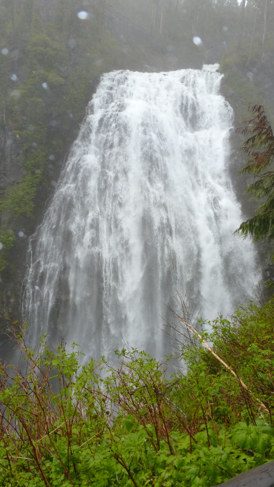
Shannon Falls
The 3rd highest waterfall in BC at 1100ft, named after William Shannon. The waters originate from Mount Habrich and Mount Sky Pilot. The park provides trail access to Stawamus Chief (see below). There is a viewing platform to get a closer look at the falls.
 |
| Shannon Falls |
Stawamus Chief
Massive 2300ft granite cliffs just a mile away from Shannon Falls. Stawamus Chief is the 2nd largest monolith granite in the world and is very popular among rock climbers. The park is very busy in summer with campers, climbers and hikers. There are 3 tough (about) 1-mile hikes to the 3 peaks with 1700-2000ft elevation gain. Gulp! We tried to climb and after about quarter mile gave up (partly coz we were still recovering from the Fremont Lookout hike and partly coz the elevation gain was just tremendous).
 |
| Stawamus Chief |
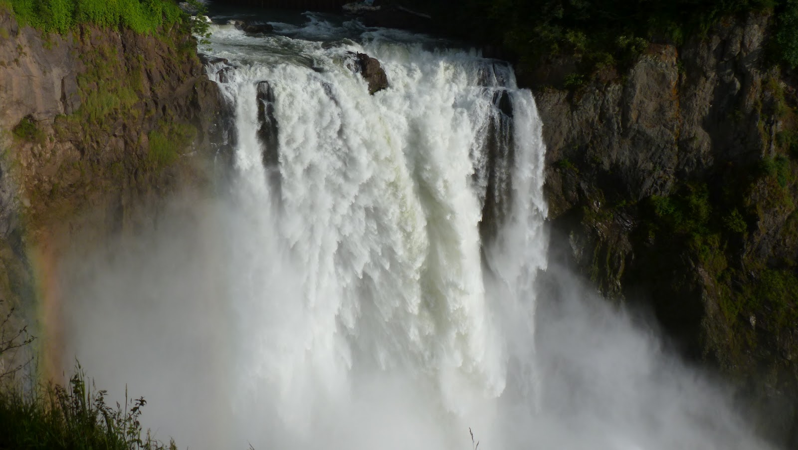
Brandywine Falls
This 230ft waterfall is best seen from the viewpoint which can be reached following the short trail. The viewpoint also provides scenic views of Daisy Lake (falls destination) and the surrounding mountains (note the black tusk).
 |
| Brandywine Falls |
 |
| Tusk |
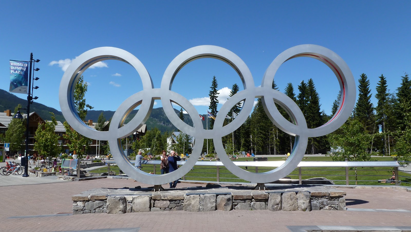
Whistler Village
The quiet mountain village of Whistler is located 75-miles north of
Vancouver. Whistler is best known for its winter
sports including world-class skiing and snowboarding and home to several
2010 Winter Olympic events. Its beautiful mountains, Whistler and
Blackcomb, are the perfect spot for summer outdoor activities too. We roamed about the village and picked 2 activities - Peak-2-Peak Gondola (their most popular summer activity) and a short trail walk.

 |
| View from Whistler Gondola |
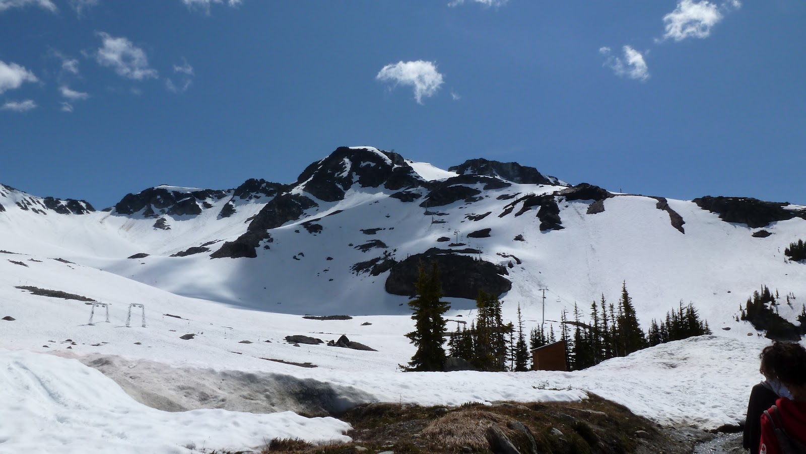
We ascended using Whistler Gondola to Roundhouse Lodge, followed by Peak-Express - a chairlift to the peak of Whistler Mountain.. brrrr.. it was very cold. At the peak we took a short walk along the trail. After getting down from the peak, we caught the P2P Gondola from Whistler's Roundhouse lodge to Blackcomb's Rendezvous - a total distance of 2.7miles. We even experienced a lift stoppage in the middle of the valley for about 25 minutes (imagine being suspended in a gondola 1430ft above valley floor). We descended Blackcomb on Solar Coaster and Wizard express.

 |
| Inukshuk @ Whistler Peak |
 |
| Black Tusk @ Garibaldi Park |

We wished to spend another day at Whistler - there is so much to do in the village.
Olympic Park
On the way back we want to stop by the Olympic Park. But they close at 4:30pm (so early?). But the detour provided us with a roadside view of bear cubs.


Cypress Mountain Vista Point
Cypress mountain lookout is a good vantage point to get an excellent photo shot of Downtown Vancouver with Mt. Baker in the background (assuming clear skies) and Stanley park in foreground.
 |
| Downtown Vancouver with Mt. Baker in background |
 |
| Lions Gate Bridge + Downtown + Stanley Park |

Night View of Vancouver from Burrard Bridge
In the evening after dinner, we walked the downtown streets to get familiarised for the next day's activity (Vancouver downtown exploration). We walked along Burrard St Bridge and took these postcard perfect pictures.


http://www.whistlerblackcomb.com/getting_here/whistler_sea_to_climb/index.htm
http://britanniaminemuseum.ca/
http://www.env.gov.bc.ca/bcparks/explore/parkpgs/shannon/
http://www.env.gov.bc.ca/bcparks/explore/parkpgs/stawamus/
http://www.whistlerblackcomb.com
http://www.env.gov.bc.ca/bcparks/explore/parkpgs/garibaldi/